Having every piece of critical data leveraged in real time has made a huge impact for Hoff and Lee.
ZoneVu’s cloud agent, RigStream™, pulls your rig data directly from the WITSML source. As it’s pulling your data, it normalizes it, depth corrects it, and brings it into your viewer, live, and automatically.
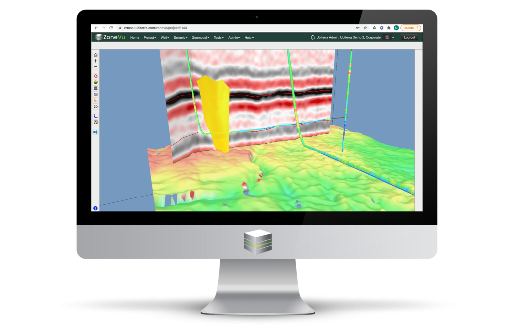
As the rig data streams into view, it melds with your full, interpreted seismic volumes. The seismic SEGY traces (in-lines and crosslines), stitch to each well as survey stations come in. You’re never drilling against a screenshot in ZoneVu.
“Being able to see everything together live, in 3D, allows you to tie the whole picture together. And where time of the essence with faulting, ZoneVu can save you time and prevent downtime,” Hoff and Lee said.
This has been critical in their more complex areas where the target is 15 feet thick, and the formation above can cause ROPs to drop from 400 feet per hour to 40 to 50 feet per hour, and the formation below poses the risk of sidetracking due to pulse-ability issues.
“It has improved our ability to react,” said Hoff, and Lee added, “we don’t have to wait for most recent survey or gamma from an email, it’s all right there.”
This combination of data in an automatic, real-time workflow doesn’t exist in any other software. And it has never existed before from a browser.